


Brazil Satellite Earth Observation Systems Industry: Environmental Monitoring, AI, and Space Technology
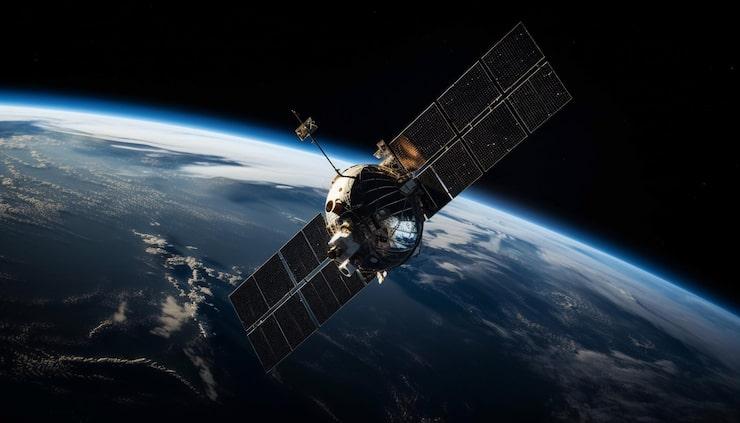
Brazil is expanding the use of satellite-based Earth observation to monitor natural resources, agriculture, infrastructure, climate conditions, and environmental changes. The country’s extensive territory and the scale of the Amazon make remote sensing particularly important for tracking land-use changes and supporting government decision-making. At the same time, advances in satellite technology and data analytics are broadening the commercial and institutional applications of Earth observation systems.
The Brazil Satellite Earth Observation Systems Market was valued at USD 80 million in 2025 and is projected to reach USD 126.5 million by 2032, expanding at a CAGR of around 6.8% during 2026–2032, according to Markntel Advisor Brazil satellite Earth observation systems market research. The Southeast region held approximately 40% of the market in 2025, while Earth observation data accounted for around 65% and Low Earth Orbit (LEO) systems approximately 62%.
Environmental Monitoring Supports Market Growth
Environmental monitoring is one of the principal factors supporting demand for satellite Earth observation systems in Brazil. Satellite imagery enables authorities to monitor forest cover, land-use changes, water resources, agricultural areas, and other environmental indicators across geographically extensive regions.
Brazil’s National Institute for Space Research (INPE) operates several satellite-based monitoring programs. The DETER system provides near-real-time alerts related to deforestation and forest-cover changes, supporting environmental inspection and control activities. These applications demonstrate the importance of timely satellite data for environmental management and regulatory enforcement.
Earth Observation Data Holds the Leading Share
By type, the Earth observation data segment represented approximately 65% of the market in 2025, making it the leading category. The segment benefits from demand among government agencies, research institutions, agriculture-related organizations, environmental programs, and other users requiring satellite-derived information.
Earth observation data can support land-cover classification, environmental assessment, infrastructure monitoring, agricultural analysis, and disaster management. As the availability of higher-resolution imagery expands, users can access more detailed information for monitoring changes across specific locations and geographic areas.
LEO Satellites Dominate Orbit Types
The Low Earth Orbit segment accounted for approximately 62% of the market in 2025. LEO satellites are widely used for Earth observation because their proximity to the planet supports comparatively high-resolution imaging and frequent revisits.
Brazil's Amazonia-1 illustrates the role of LEO-based Earth observation. According to INPE, the satellite is designed to provide frequent coverage and supports applications including monitoring of biomes, agricultural areas, water reservoirs, coastal zones, and areas affected by environmental disasters. The satellite completed five years in orbit in February 2026 and continues to provide imagery for Brazilian monitoring activities.
AI and Machine Learning Transform Satellite Data
Artificial intelligence and machine learning are becoming increasingly relevant to Brazil's Earth observation ecosystem. Satellite missions generate substantial volumes of imagery, creating a need for automated systems capable of processing, classifying, and interpreting data efficiently.
AI-based analysis can support land-use classification, change detection, environmental monitoring, and predictive analytics. These capabilities can help convert raw satellite imagery into information that government agencies, agricultural organizations, and research institutions can use for operational decision-making.
The combination of satellite imagery with machine-learning tools is therefore shifting Earth observation from basic image collection toward more automated and data-driven analysis.
Precision Agriculture Creates New Opportunities
Agriculture represents an important opportunity for satellite Earth observation in Brazil. Satellite imagery can help monitor crop conditions, identify changes in land use, assess vegetation, and support precision agriculture practices.
High-frequency imagery and time-series analysis can provide information about crop development and agricultural land conditions over large areas. These capabilities can support more targeted decisions related to irrigation, crop monitoring, resource allocation, and sustainable land management.
The expansion of agricultural applications also creates opportunities for commercial satellite-data providers, analytics companies, agricultural technology firms, and institutions developing digital farming solutions.
New Satellite Missions Strengthen Capabilities
Brazil continues to develop and participate in new Earth observation missions. The CBERS-6 program is an important example of international cooperation in satellite technology. According to INPE, the mission is planned to include an X-band Synthetic Aperture Radar (SAR) payload, allowing observations during both day and night and under conditions such as cloud cover.
The INPE's CBERS-6 program shows continued technical collaboration between Brazil and China in satellite image processing, environmental monitoring, calibration, and mission operations. The planned SAR capability can complement optical satellite data and expand observation possibilities.
Southeast Region Leads the Market
The Southeast region held around 40% of the Brazil satellite Earth observation systems market in 2025. Its leading position is associated with the concentration of space research institutions, technology companies, infrastructure, skilled professionals, and commercial users.
The region's established research and industrial ecosystem supports satellite development, data processing, and Earth observation applications. Its proximity to government institutions, agricultural organizations, infrastructure operators, and other potential users further strengthens demand for satellite-derived information.
High Development Costs Remain a Challenge
The development and deployment of Earth observation satellites require substantial investment in spacecraft engineering, sensors, launch services, ground infrastructure, testing, and operations. These costs can create barriers for smaller organizations and private-sector entrants.
In addition to satellite development, data processing infrastructure and specialized analytical capabilities require continued investment. As Brazil expands its Earth observation capabilities, balancing technological ambitions with development and operational costs will remain important for market participants.
Market Outlook
Brazil's satellite Earth observation systems market is expected to develop steadily as environmental monitoring, agriculture, disaster management, infrastructure assessment, and security applications increase demand for timely geospatial information. Earth observation data and LEO satellites are likely to remain central to the market, while AI and machine learning continue to improve the processing and interpretation of satellite imagery.
With the market projected to reach USD 126.5 million by 2032, continued investment in domestic satellite capabilities, international cooperation, advanced sensors, and data analytics is expected to shape Brazil's Earth observation ecosystem over the forecast period.

 English
 Arabic
 French
 Spanish
 Portuguese
 Deutsch
 Turkish
 Italiano
 Russian
 Romaian
 Portuguese (Brazil)
 Greek
